


The Pamir Highway - Part 5
Day 5: From Ishkashim to Rachiv


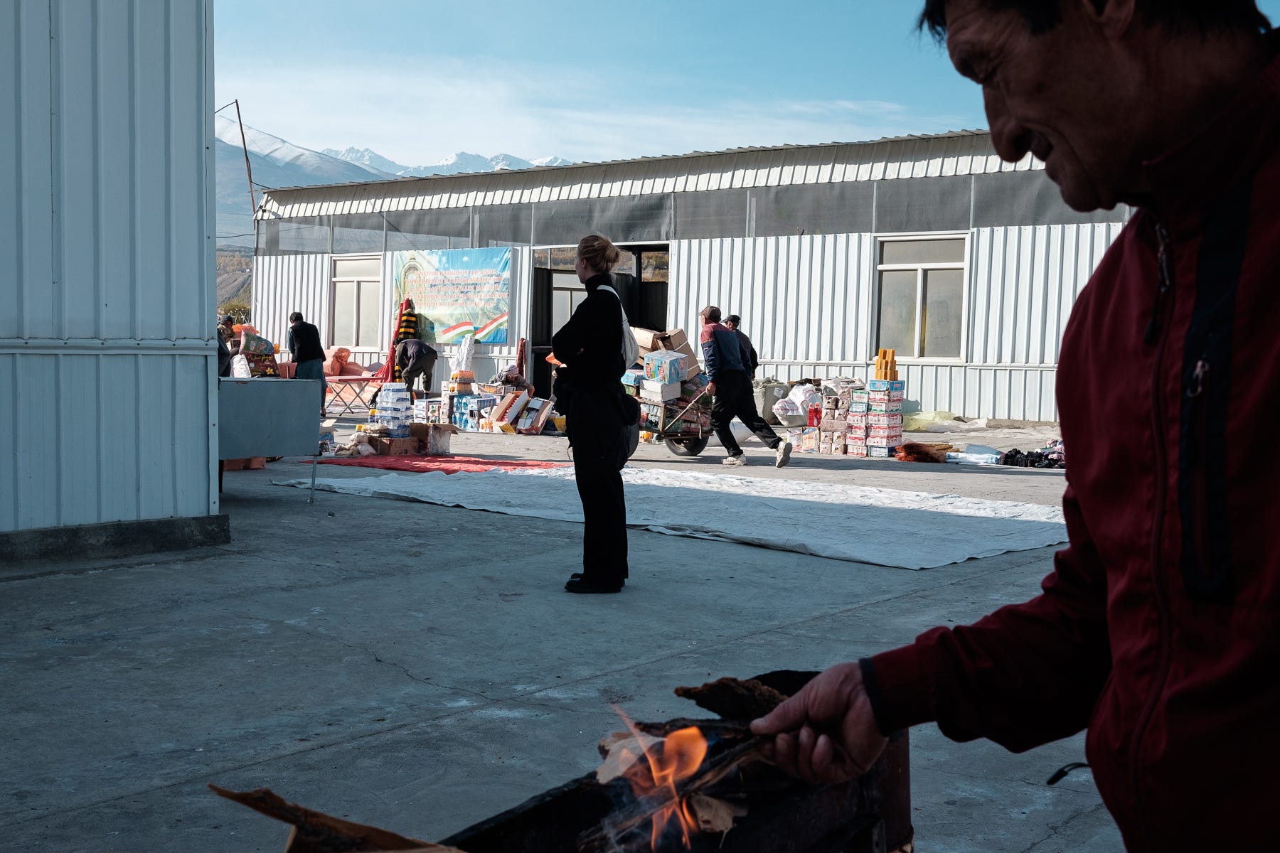
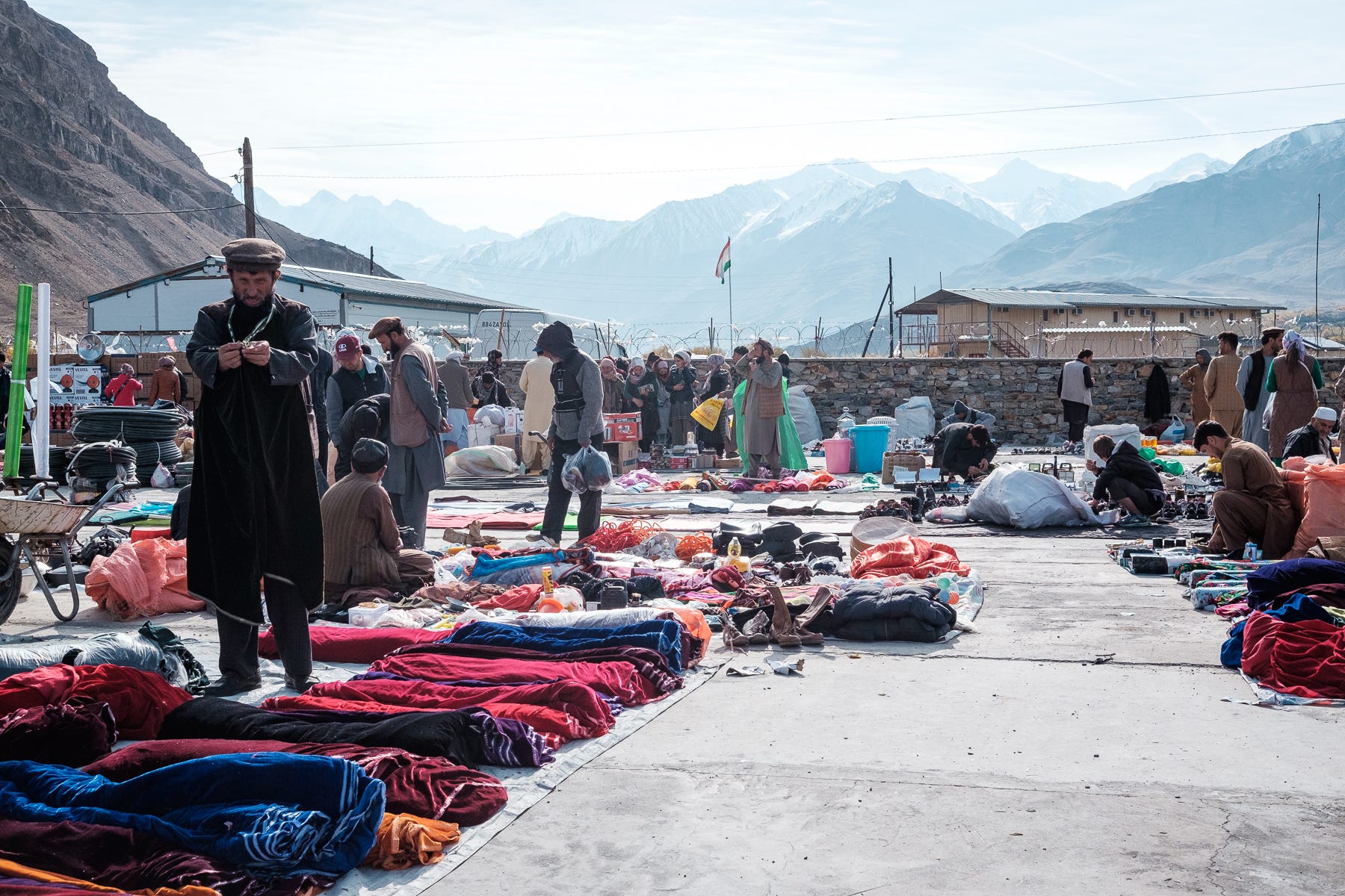
We woke up early: every Saturday morning, on an island in the Panj river, takes place a cross-border market. As a matter of fact, the town on the Afghan side is also called Ishkashim, and the people on both sides are ethnically undistinguishable and speak the same Tajik dialect. The border used to be open. In the years immediately following the dissolution of the Soviet Union, many tons of Afghan heroin used to traverse it, so that couriers using the Dushanbe-Moscow night train could take it to the Baltic Republics and from there flood the European market. These days, the border is closed to locals and tourists alike, although the heroine flow – now fording the Panj river on foot – has not stopped. The only official point of contact for the people on the two sides is the market, which technically takes place in a no-man’s-land: not in Tajikistan, not in Afghanistan.
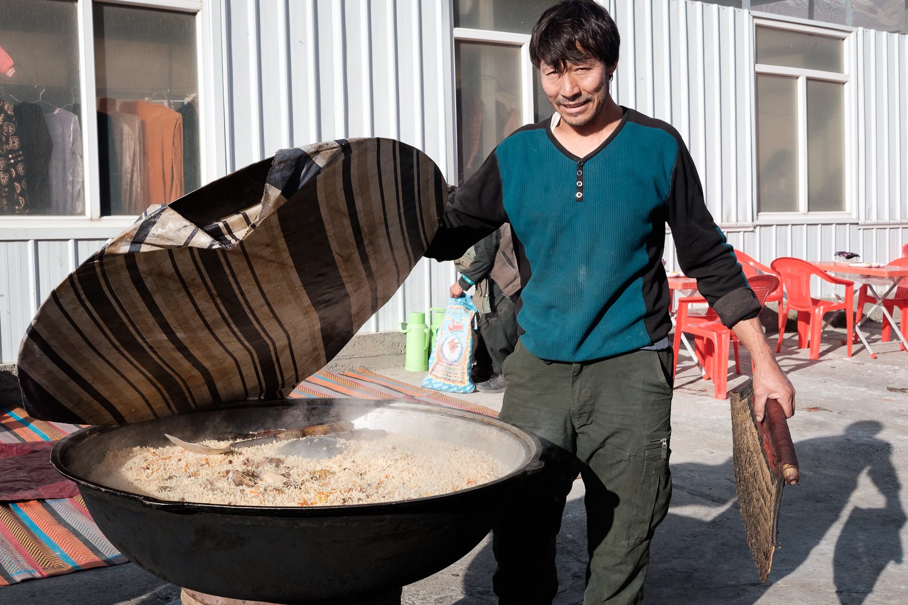
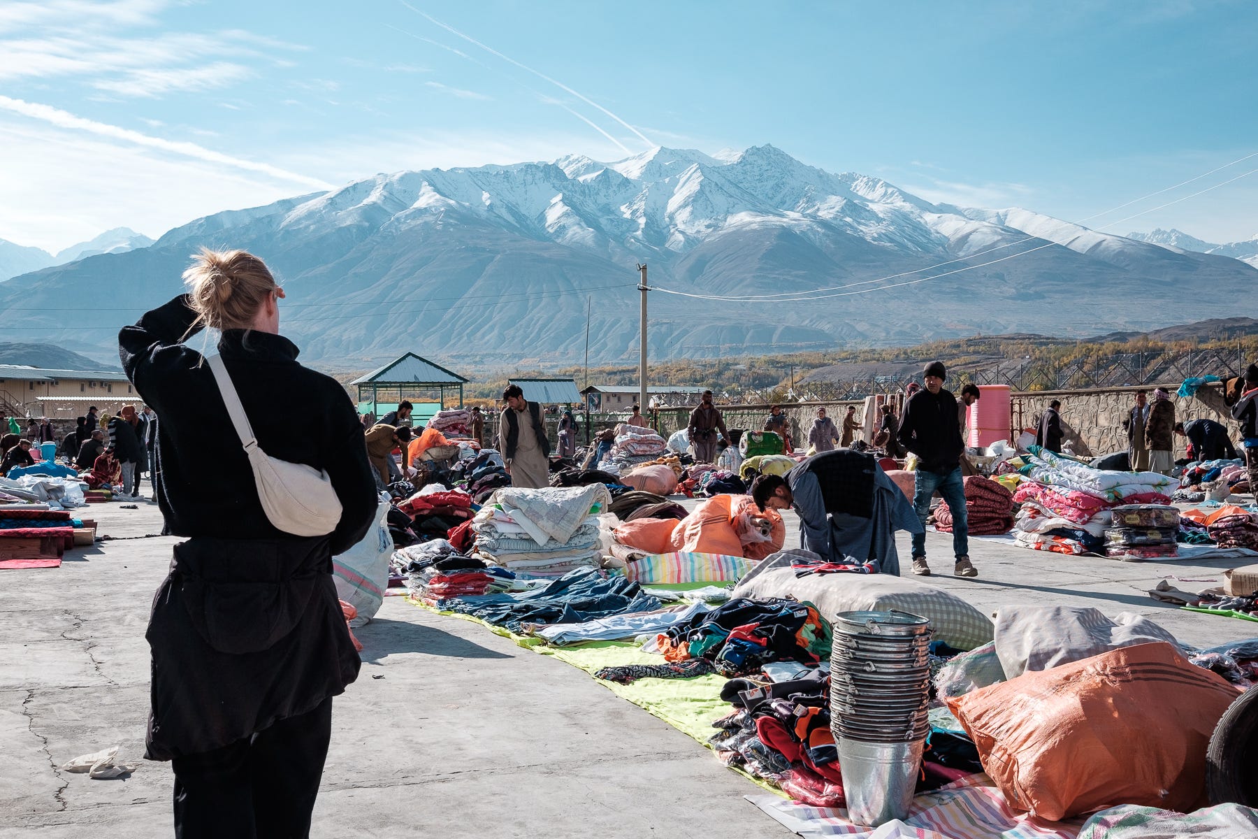
The Tajik guards took pictures of our passports before letting us on the bridge. We were the first to reach the island from the Tajik side, and could observe the first Afghans coming. We realized that the situation was very unbalanced: all the Afghans were here to sell, while the Tajiks only shopped. On the Afghan side was an enormous line of sellers that had been queuing at the gate, waiting for it to open. Only a limited number would be let through. This market is an occasion for the Tajiks to buy items and produce at a cheaper price than in their country. We observed the sellers setting up their little stalls, which are actually just a rug on the floor where they exhibit their products. On a corner of the market we found food sellers. We took a sit, and a kind Afghan man served us black tea and shashlik/kebab (local skewers that here are prepared exactly like the Italian arrosticini).
We strolled through the market, which was now in full swing: most people sold second hand clothes and shoes. The produce section was dominated by beautiful pomegranates, one of the best agricultural products of Afghanistan. Xavier bought a pakol, the traditional flat Afghan hat. We also found a 1937 Afghan coin that had been turned into a keychain and added it to our van keys. As we left the market, a man shouted, “You should visit Afghanistan!”, we said “Maybe we will”, thinking it was a polite lie. Little did we know that we would, in fact, visit Afghanistan a few months later.
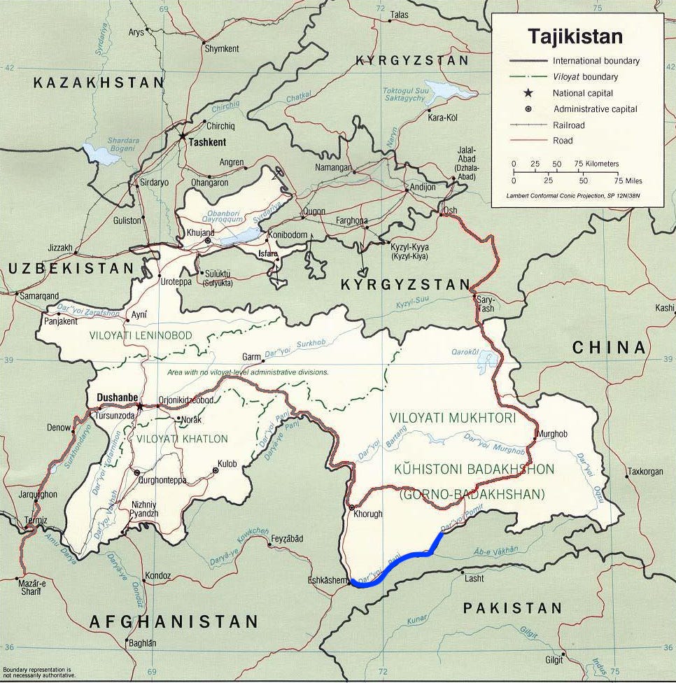
The good-weather window allowing us to drive through the Pamir in our 2WD van was not endless, and we had to keep moving. Back in the van, we were now driving along the Wakhan corridor. This is a cartographically odd bit of Afghanistan, that extends like a finger all the way to Chinese Xinjiang. It consists of a thin strip of land delimited by the Panj river to the North and by the Hindu Kush main ridge to the South. Its existence is the result of the geopolitical Great Game played between the Russian and the British empires in the 19th century. At the peak of their expansion, the Russians controlled the Russian Turkestan region (nowadays Tajikistan) while the British ruled over the British Raj (including nowadays northern Pakistan). As both empires had been expanding and were close to making contact, the unclaimed 20km-wide Wakhan corridor was offered to the Afghan Khan to form a buffer zone between the two large rivals.

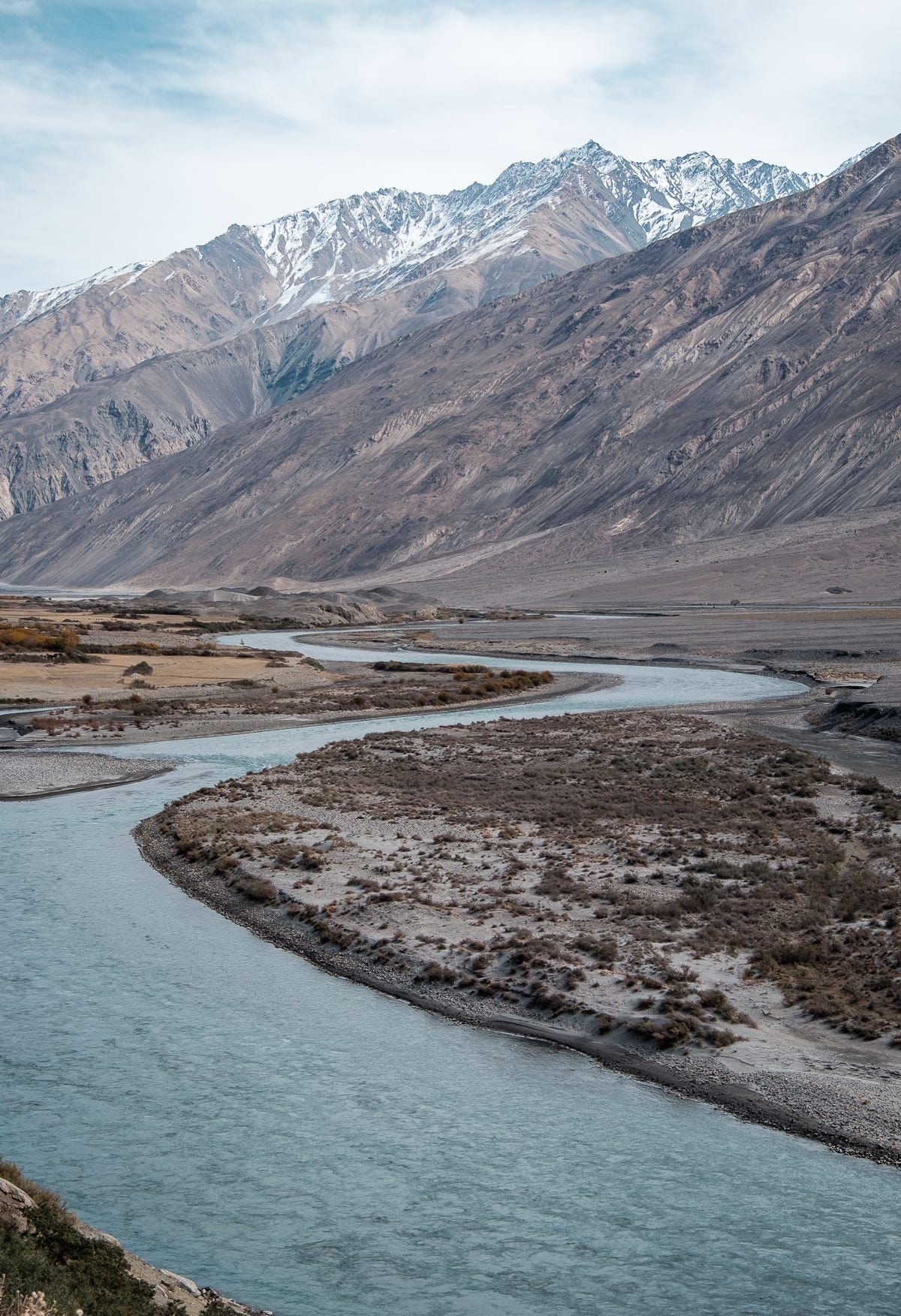
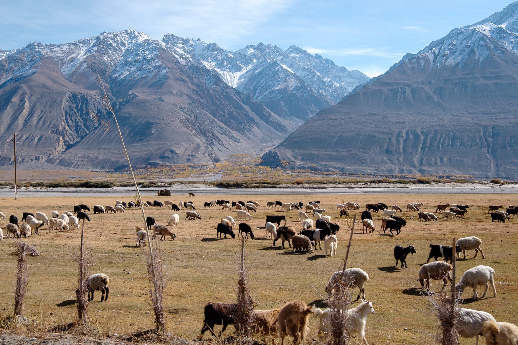
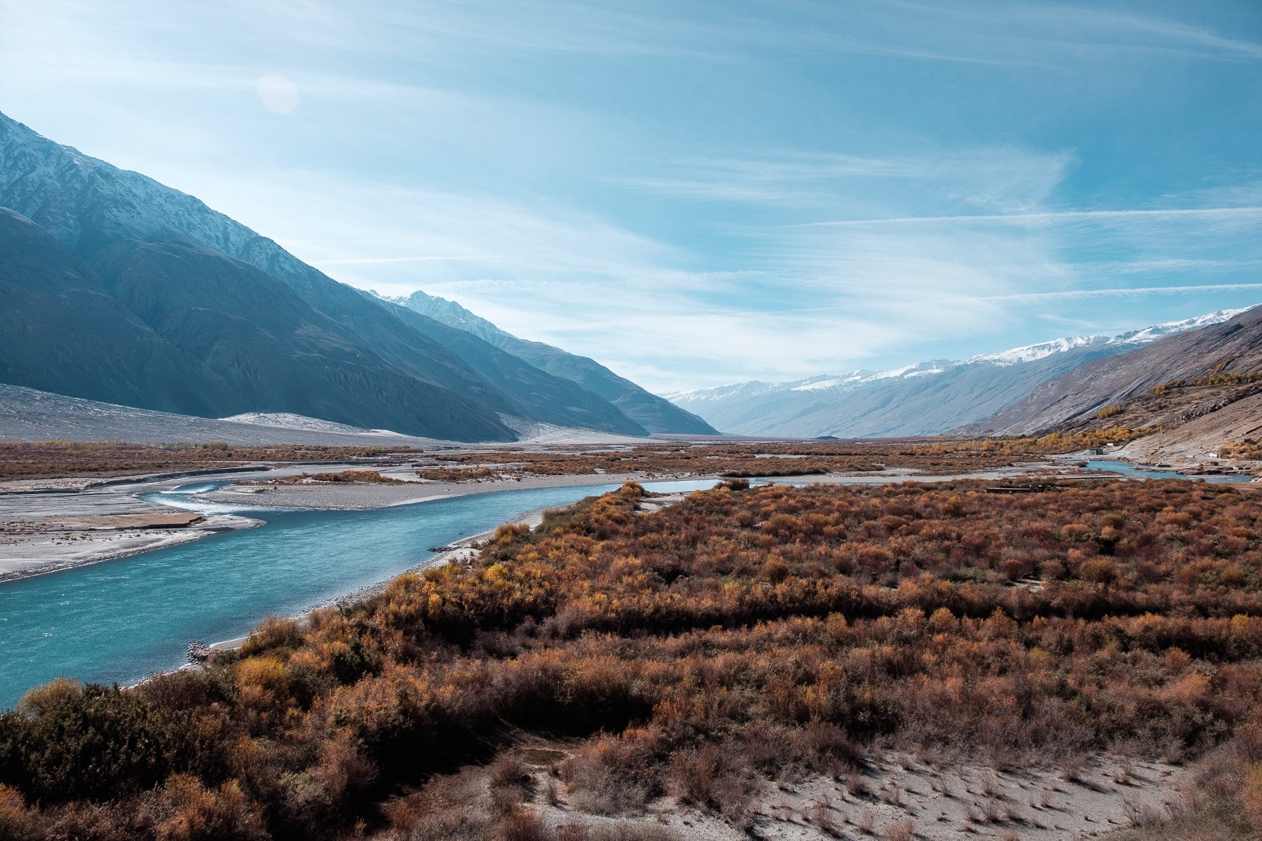
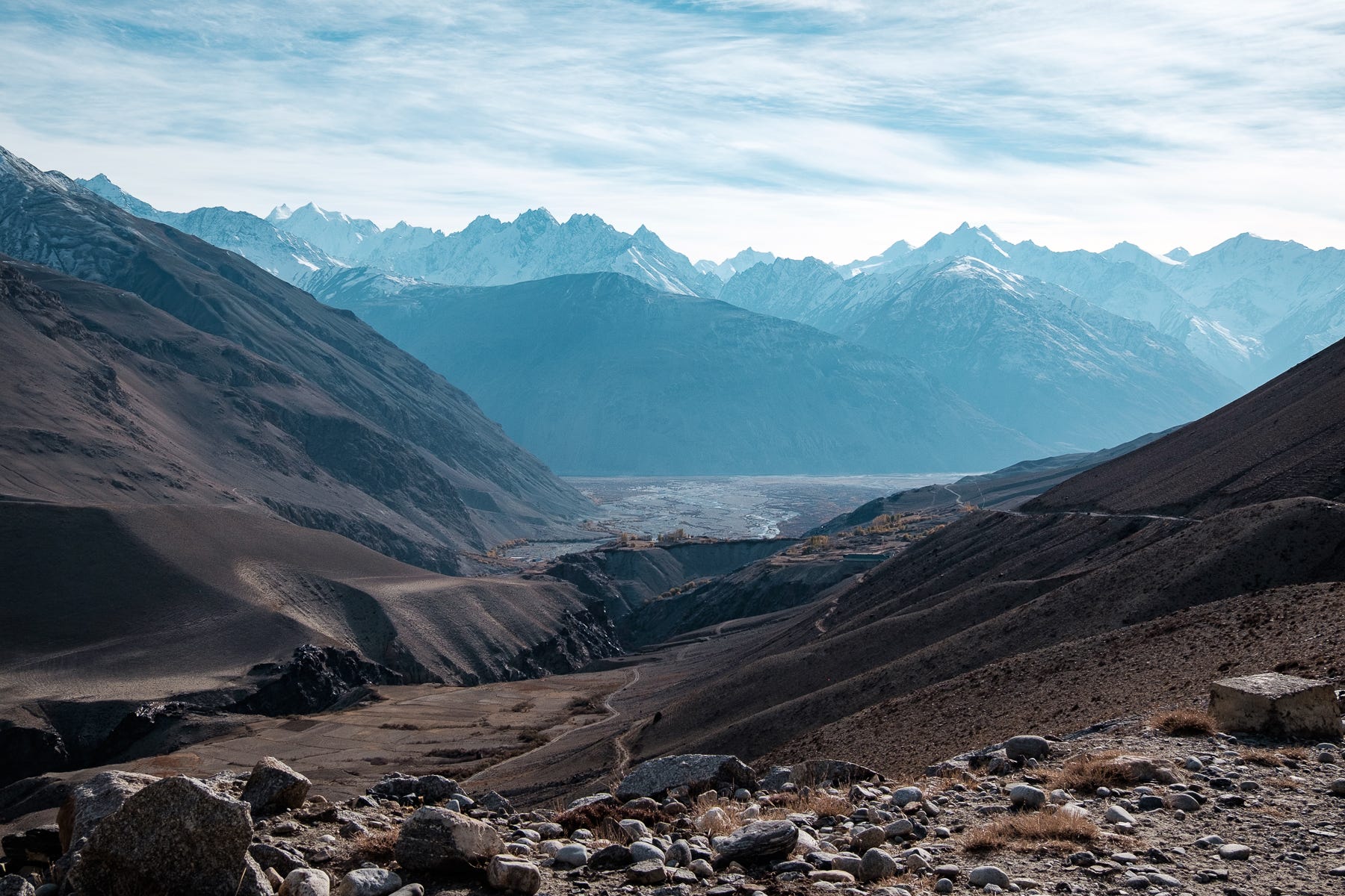
Leaving Ishkashim, the Wakhan valley becomes suddenly wider than the steep gorges we had been following until now. The valley floor is flat and allows for farming. The flood plain was dotted by goats, donkeys, cows, and sheep, and at times the river expanded to form a winding mirror that reflected the mountaintops far into the distance.
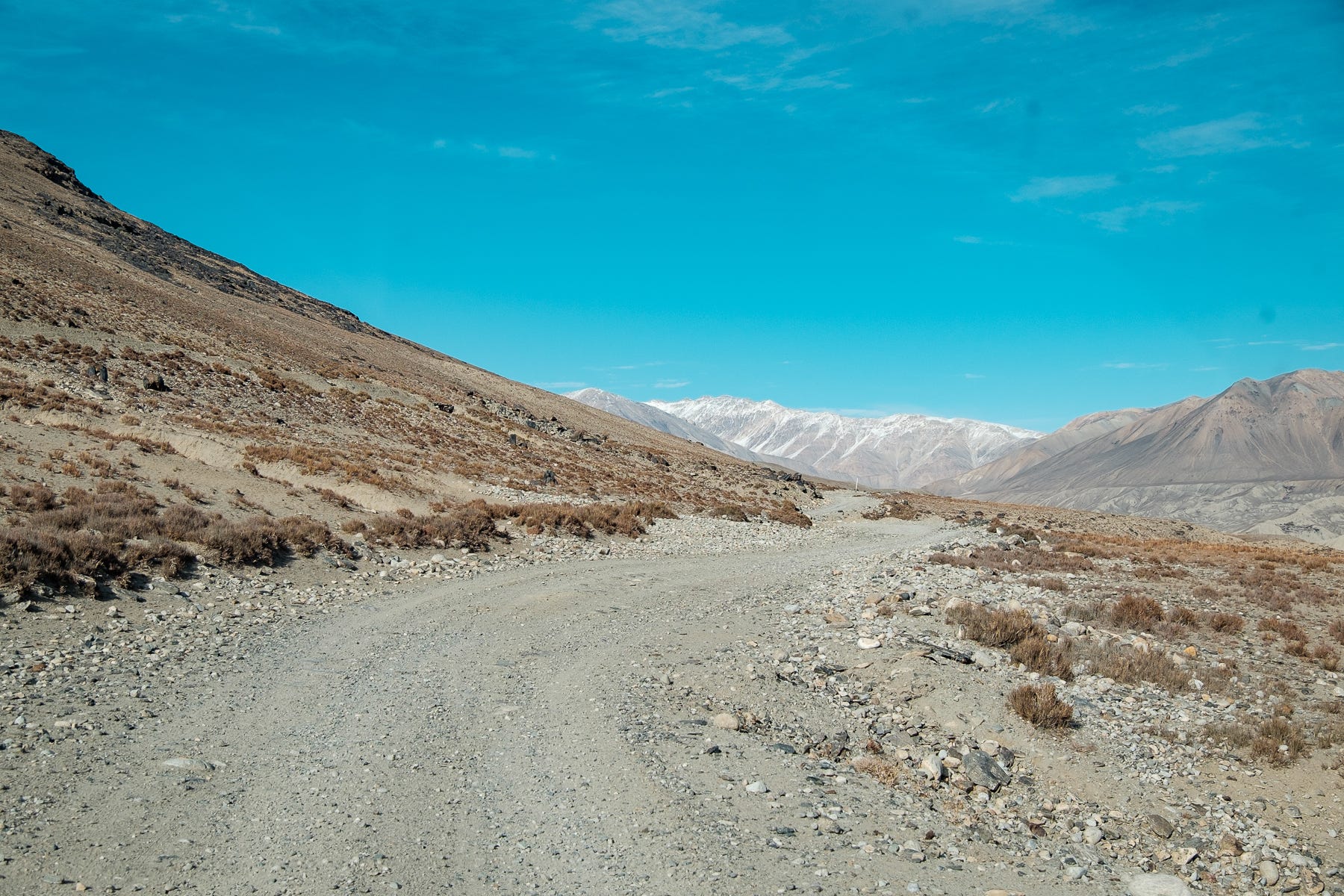
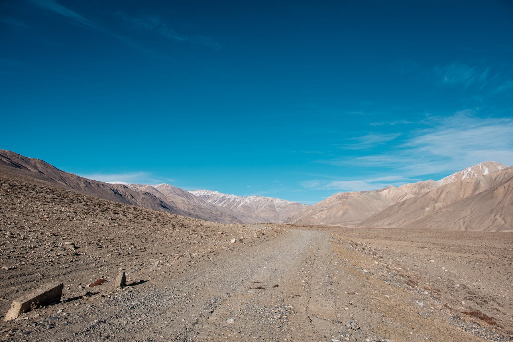
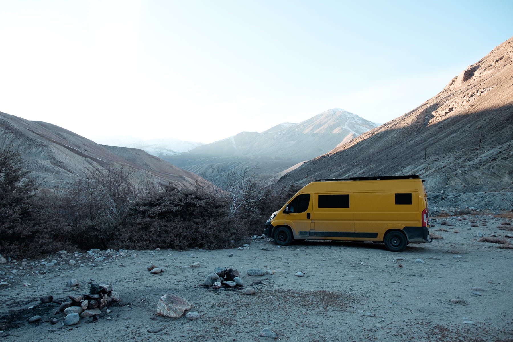
The asphalt sections that until here formed some parts of the road were suddenly over, and only sand, gravel, and dirt were left. And not any kind of dirt road. Here began long sections of what’s called a washboard: a compact dirt road that has been turned into a sequence of tightly packed transversal ripples by the passage of vehicles. In practice, it’s like driving over never-ending little bumps that make everything rattle and vibrate. In a 3 tons van, it means we had to often slow down to 10km/h just not to go insane.
We slowly reached Langar, the last village in the lower part of the corridor. From here, the flats were officially over, and the climbs began. We could only see a really steep and little road leaving the village, and asked a local for confirmation. He said “Da, da, Murghab!” and pointed upwards with his finger. The road we had taken until here is used by the locals to reach the rest of the country – from where we arrived – but people living up in the plateau use the main M41 Pamir Highway, which takes them directly to Khorog by skipping the Wakhan corridor. This means that the connection between Langar (where we were) and the high Pamirs (where we were going) is used almost exclusively by a handful of overlanding tourists. Along this connection there are no inhabited villages, only a few hunting houses and a military checkpoint. This is why this road, seldom used, suddenly becomes steep, narrow, and poorly maintained.
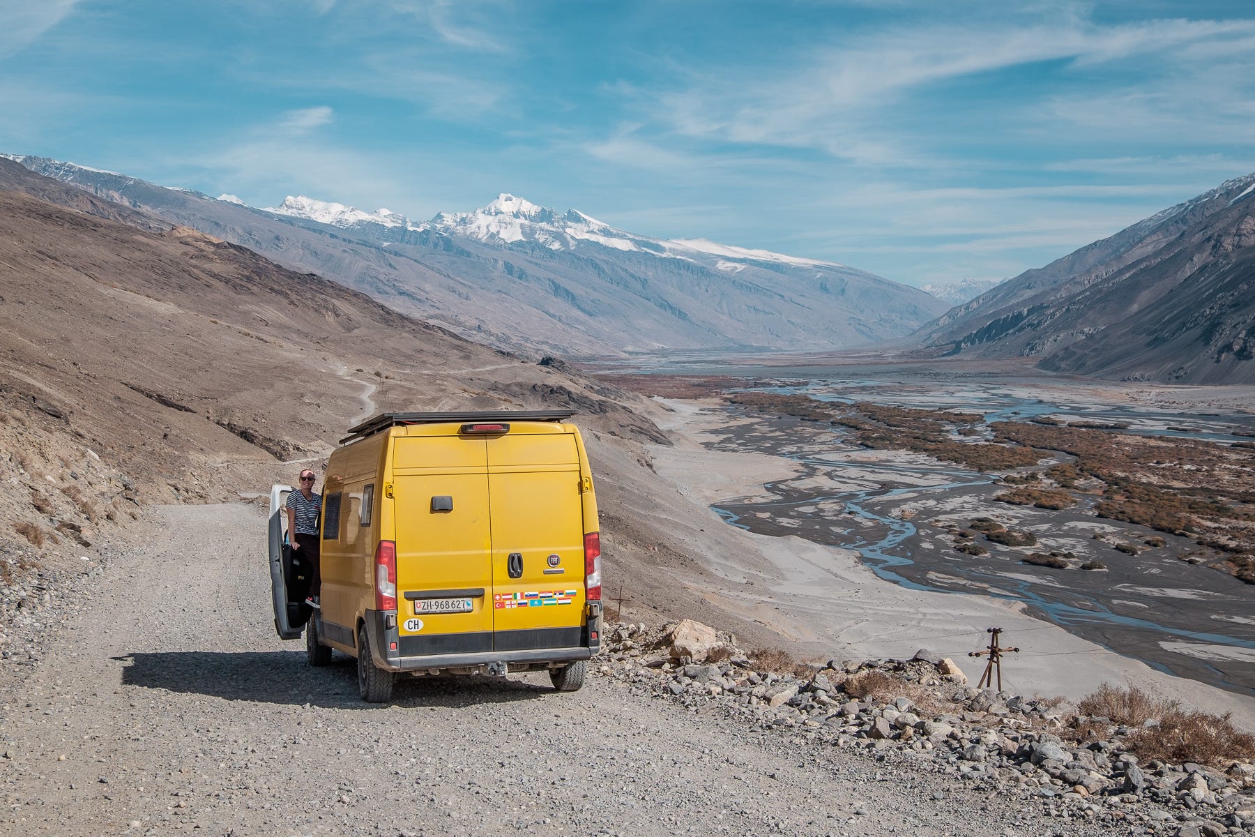
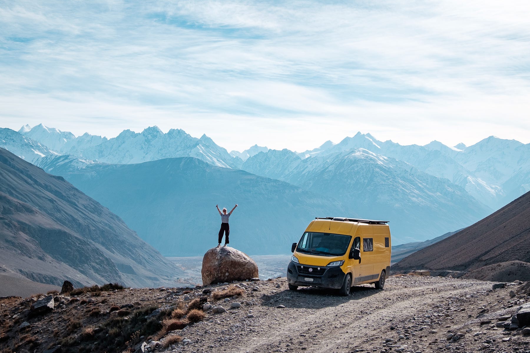
Our van was immediately put to the test by the steep hairpin turns out of Langar, and we were immensely grateful for our off-road tires – thank you Xavier’s parents for the Christmas gift! Driving fast to maintain power and traction on the steep inclines, we were making our way up steadily.
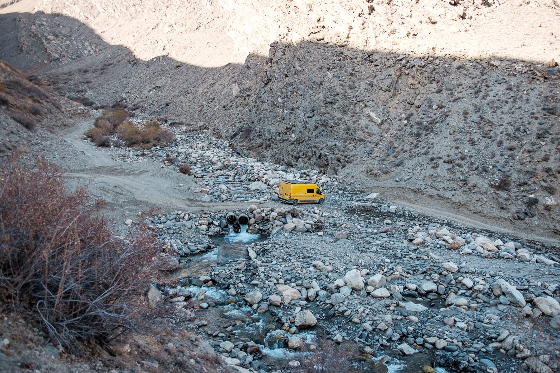
With apprehension, we approached what had been described to us as the trickiest point on the entire road: this spring, a bridge at 3400m had been destroyed by the water, and now the road simply forded the river at its narrowest point. The locals had installed two large water pipes, and driving over them required a vehicle with much more ground clearance than we have. We were expecting to stop here for the night and dedicate some time to creating a stone ramp for the pipes. Just 1km before the fording point, we crossed the only vehicle we would meet on this connection: a huge bulldozer. We wondered what it was doing here, and only when we reached the river ford we realized our luck.
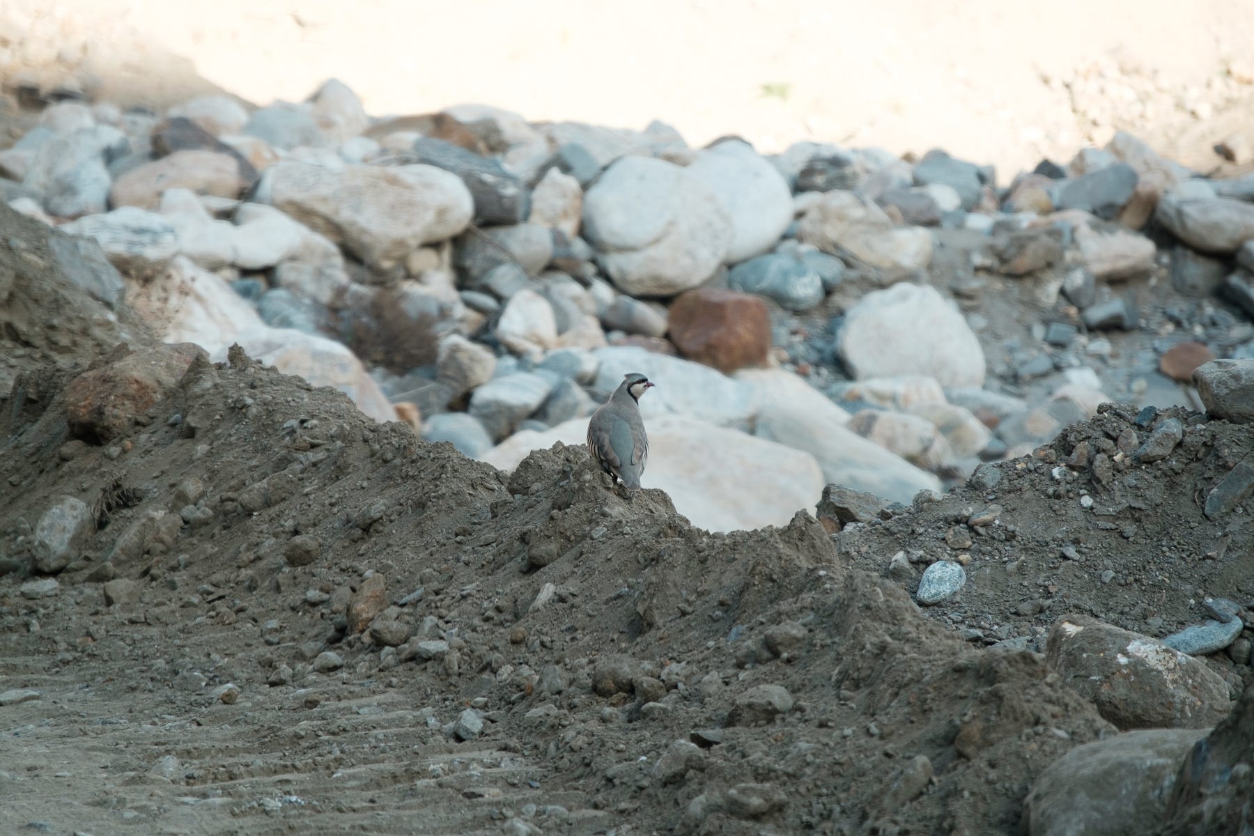
The water pipes had been covered by a perfect, compact layer of dirt, and the rest of the fording – which used to be done in deep water and over large rocks – had been flattened. On top of this, thanks to the cold weather only little water was flowing. Before we knew it, we were easily on the other side of the river, relieved from the worries that we had been harboring about this passage. We observed a few partridges – still in their summer dress – running through the stones, and silently appreciated our luck.
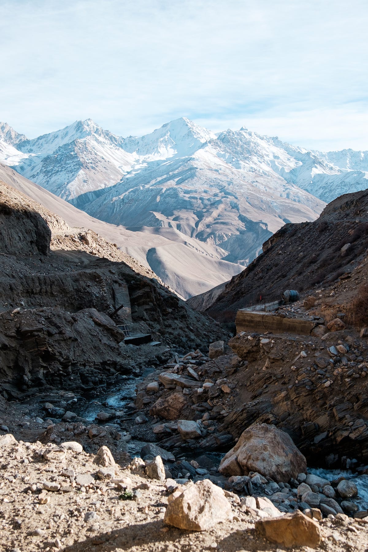
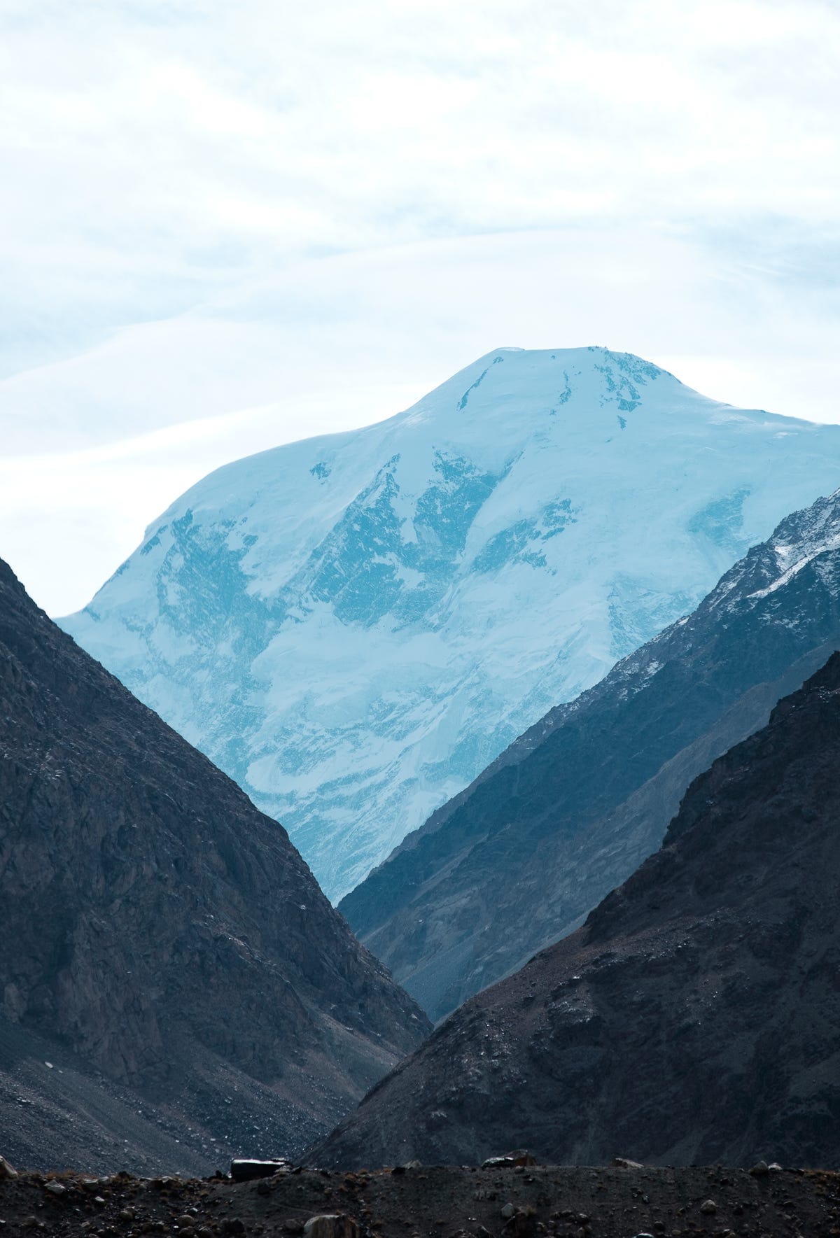
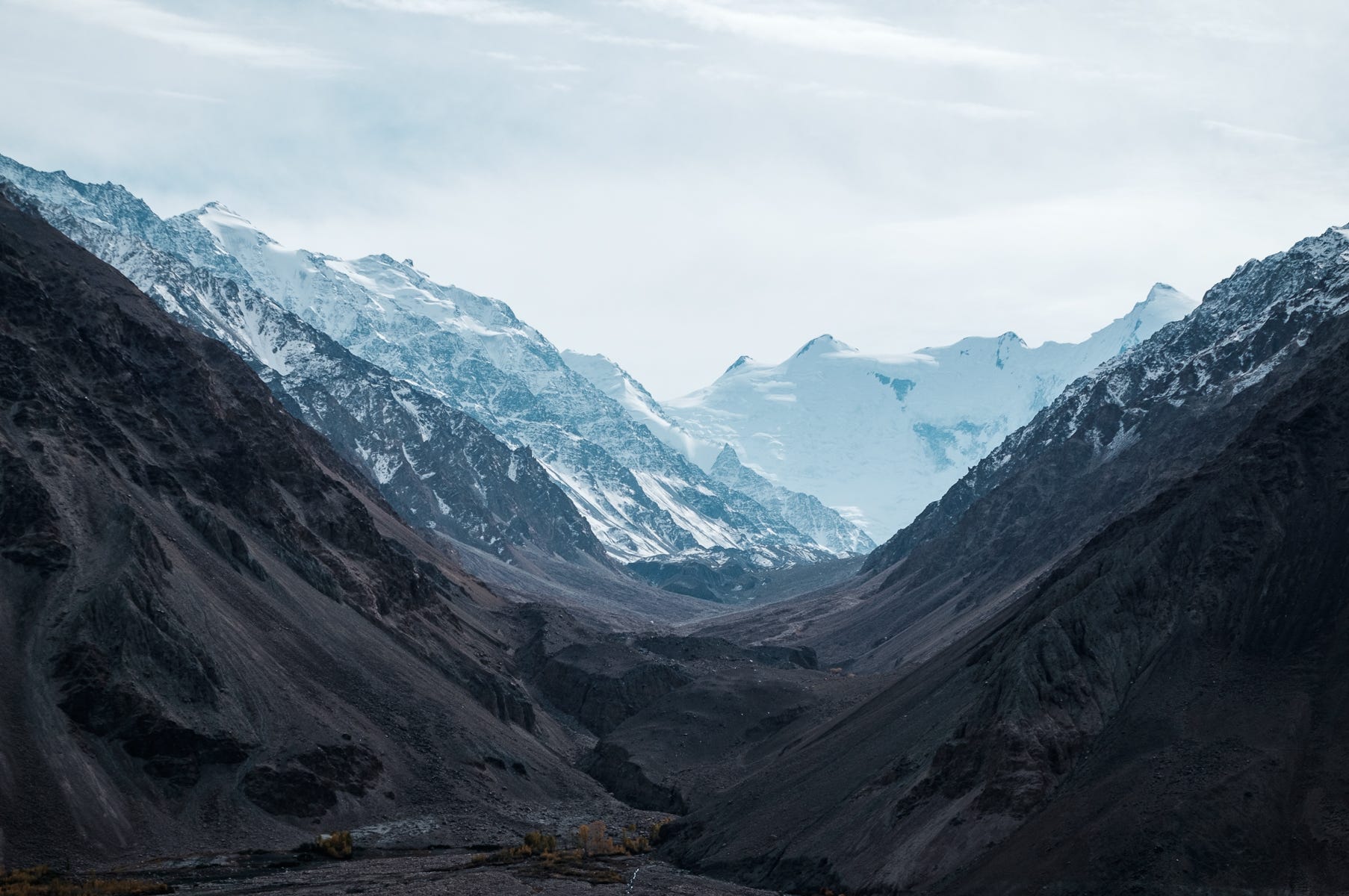
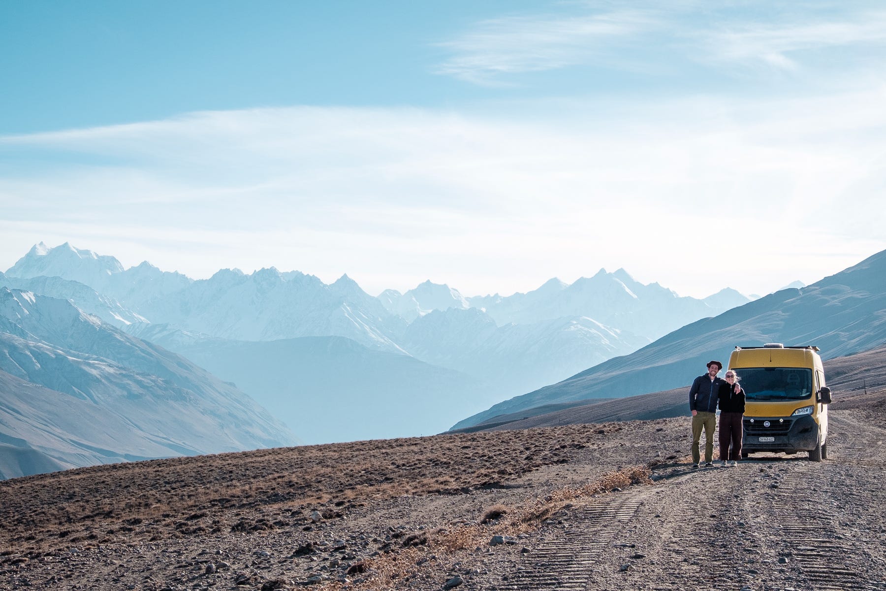
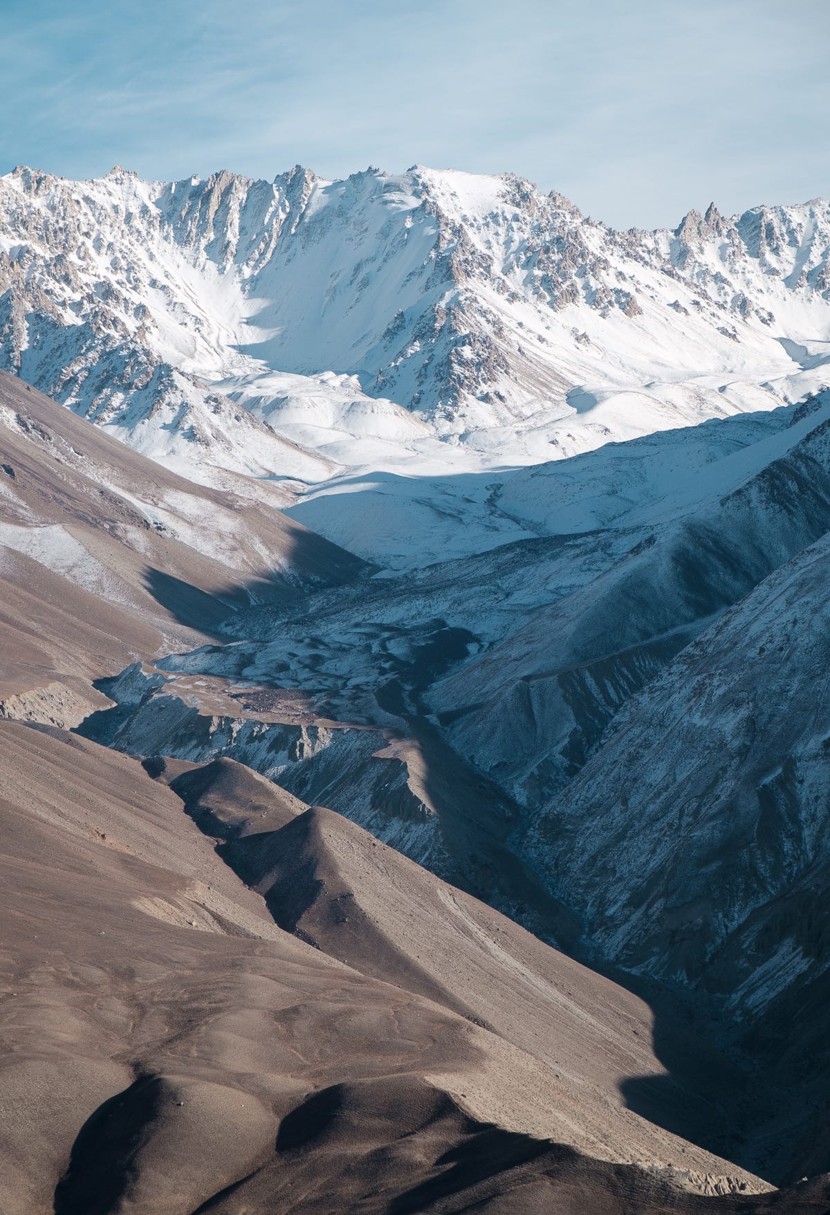
We drove a little further on gravel and sand, and at 3700m we stopped to admire the surrounding landscape. From this higher plateau we could see Engel’s Peak, the Koh-i-Baba, and the entirety of the Hindu Kush, behind which lies Pakistan. Most of these peaks reach higher than 6000m, and some almost make it to 7000m.
The last light of the day accompanied us to a little flat spot on the riverside at 3500m, where we stopped for the night. Afghanistan was an arm’s length away, just across shallow waters. Looking around, we startled a hidden wild rabbit. It made a dash for the nearest bush and disappeared. There was no one else around.
We’re publishing this story in parts. Next time: Day 6 - from Rachiv to Murghab
I'm so proud of you!
I love the hat :-D